
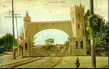
The Olentangy Amusement Park, located in Columbus, Ohio was one of the few attractions of that type in the city. From groundbreaking in 1880 to its closure in 1939, the park switched hands many times, with each successive owner adding rides and activities to the park.
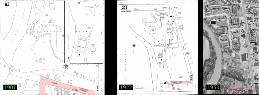
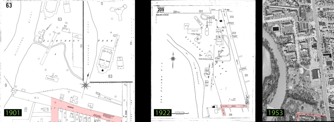
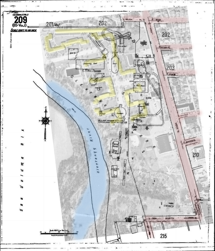
By 1953, save for the large pool (dark rectangle, upper left corner of 1953) there was little semblance of any of the parks former rides. (Images courtesy of Sanborn Maps and USGS)
The End of the Park

In 1939 the park was sold to the LeVeque Company (of the same LeVeque Tower in Downtown Columbus). They got rid of nearly all the remaining rides and used to the land to build Olentangy Village.
In the image on the left, the 1922 site is overlayed with the 1953 aerial image. The yellow represents the buildings in the village and how they occupied nearly all the land of the former attractions. The building that lies at High and Olentangy St was a bowling alley which burned down some time ago.
The Park Site Today

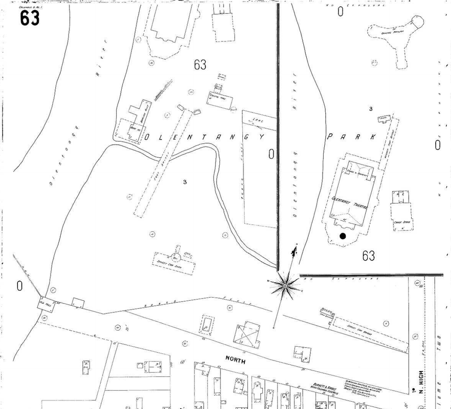
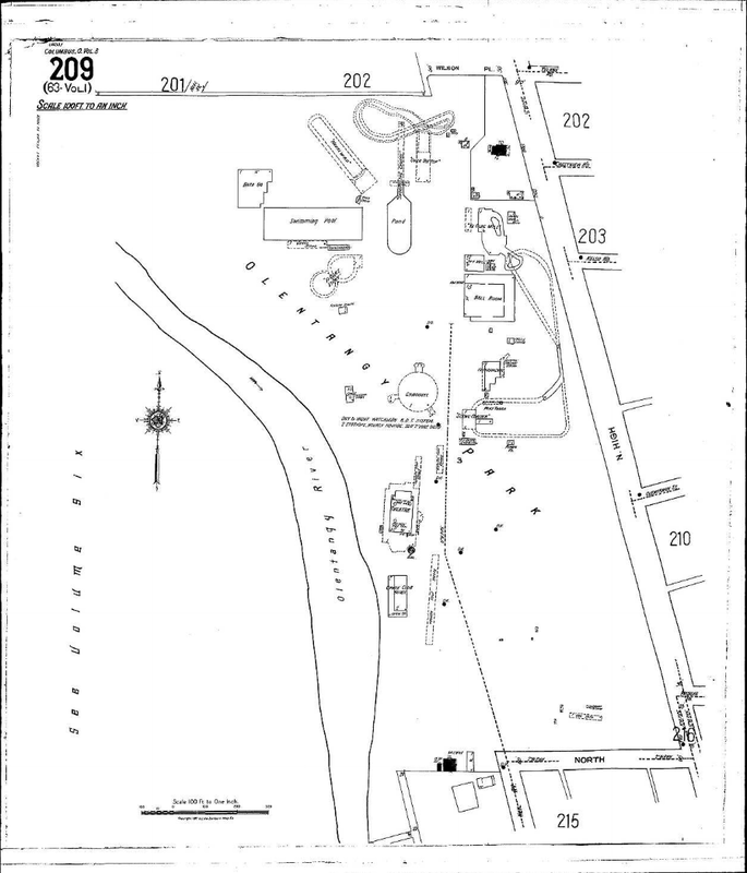
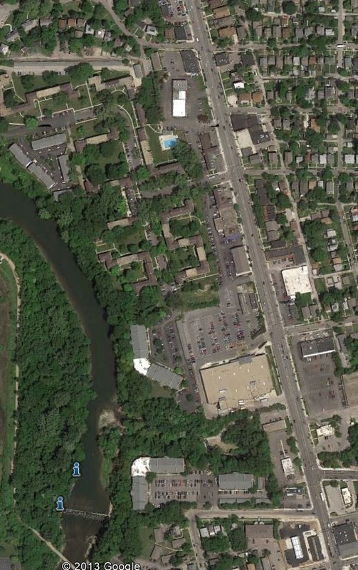
Until 2002 the only remnant of the park still existing was (half) of the in-ground pool built in the 1920s. When the Olentangy Village opted to expand its structures in 2001 the pool was unfortunately lost. The streetcar entrance with the castle gate was located where Patrick J's stands now.
The ditch/ravine still exists just north of North St. and south of Giant Eagle. At the point where the drain canal meets the Olentangy River once lay the canoe house and foot bridge, which may still exist. I plan on checking out the area for myself once my camera gets fixed (hopefully soon).
Its sad that none of the park made it to modern times, but for the 60 years it was open it was once of the greatest attractions in Columbus.
As soon as I get down to examining the site for any remains, I'll post back here with an update and pictures. Stay tuned!
(Information for this post comes from my own research, Sanborn Insurance Maps, USGS, Google Earth, and Wikipedia)

 RSS Feed
